Home /
Our Projects /
Slope Stability Analysis, Rock Slope Protection…
Geotechnical Engineering
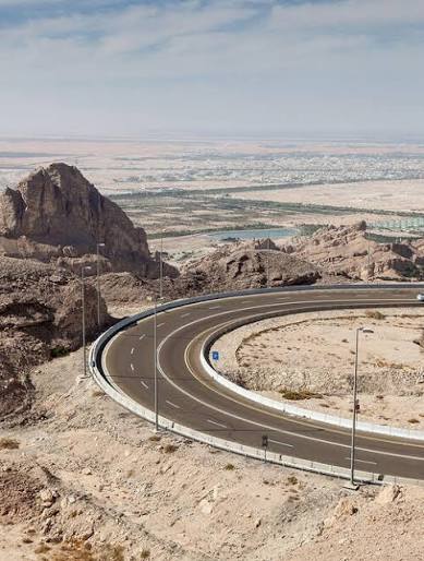
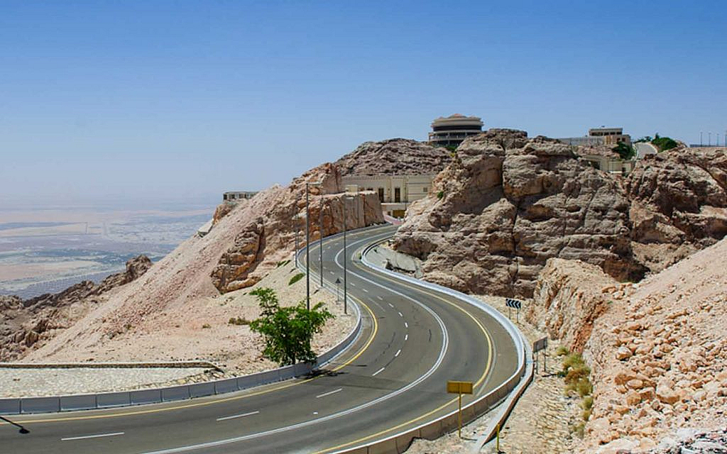
Slope Stability Analysis, Rock Slope Protection Design & Advanced Remote Sensing – Historic Mubazzarah Dam Road, Al Ain
Specialist geotechnical engineering services for the Historic Mubazzarah Dam Road project in Al Ain, covering rock testing programme definition, laboratory results review, advanced rock slope stability analysis, and rock slope protection design.
Client
ADM
Contractor
NOOR ALSAHRA
Location
ALAIN
Year
2026
Status
Completed
Overview
The project involves the engineering assessment of rock slopes along the Historic Mubazzarah Dam Road in Al Ain to support slope stability evaluation and the development of appropriate rock slope protection measures. Super Arc Consultant LLC (SAC) provides specialist analytical services, including defining the required rock testing programme, reviewing laboratory test results, and incorporating rock mass classification parameters provided by the appointed geological or geotechnical specialist.
The scope includes advanced numerical modelling of representative and critical slope sections to evaluate stress–strain behavior, deformation patterns, and slope stability under existing and potential adverse conditions. In addition, SAC recommends integrating PS-InSAR and CCD analysis to identify potential long-term slope movements and sudden surface changes, supporting hazard prioritization and monitoring recommendations.
Scope of Work
Define the rock coring and laboratory testing programme based on available geological information, drawings, and slope geometry.
Review laboratory reports covering applicable rock strength and material properties, including UCS, point load index, Brazilian tensile strength, density, porosity, and discontinuity shear strength.
Review the engineering consistency of RMR and GSI values provided by the appointed geological or geotechnical specialist.
Incorporate laboratory-derived parameters and supplied rock mass classifications into slope stability assessments.
Perform finite element analysis using PLAXIS 2D and/or PLAXIS 3D for representative and critical slope sections.
Evaluate rock mass stress–strain behaviour, deformation patterns, and stability under in-situ and potential adverse conditions.
Undertake supporting kinematic and limit equilibrium method (LEM) analyses to assess potential failure mechanisms.
Develop rock slope protection design and engineering recommendations based on the analysis results.
Conduct recommended PS-InSAR analysis using Sentinel-1 ascending and descending datasets.
Perform Coherence Change Detection (CCD) to identify potential rockfall, erosion, and other surface changes.
Integrate remote sensing findings with the slope stability assessment to support hazard identification and monitoring recommendations.
Prepare a consolidated Slope Stability and Protection Design Report suitable for Engineer review and approval.
Project Highlights
Advanced Rock Slope Engineering and Remote Sensing for Historic Mubazzarah Dam Road, Al Ain
01Specialist geotechnical assessment of rock slopes along a historic dam road corridor.
02Definition of rock testing requirements and technical review of laboratory outputs.
03Integration of rock mass classification parameters, including RMR and GSI, into stability assessments.
04Advanced PLAXIS 2D/3D finite element modelling to evaluate rock mass behaviour and slope stability.
05Supporting kinematic and limit equilibrium analyses to identify potential failure mechanisms.
06Development of rock slope protection and monitoring recommendations.
07Application of recommended PS-InSAR and CCD techniques for identifying progressive slope movement and potential sudden surface changes.
08Integration of numerical modelling and satellite-based remote sensing to support slope hazard assessment and risk prioritisation.
09Preparation of a consolidated technical report for Engineer review and approval.
Outcome
Integrated Rock Slope Stability Assessment and Protection Design for Enhanced Road Corridor Safety
Defined rock testing programme and technical review of laboratory results.
Engineering assessment incorporating laboratory parameters and RMR/GSI values supplied by others.
FEA-based evaluation of rock slope stability, deformation behaviour, and potential failure mechanisms.
Engineering recommendations for suitable rock slope protection measures.
PS-InSAR displacement analysis and CCD mapping to support identification of potential slope instability and surface changes, if adopted.
Integrated interpretation of geotechnical analysis and remote sensing findings.
Monitoring recommendations to support future slope condition assessment and risk management.
Consolidated Slope Stability and Protection Design Report suitable for Engineer review and approval.
The project involves a comprehensive Structural and Hydrological Inspection to address the rising ground water level challenges. This includes field and laboratory testing, defect mapping, and…