Is identifying the proposed road alignment enough to start detailed design? For road widening in Abu Dhabi, the layout needs to be considered alongside existing utilities, drainage, connections to surrounding roads and the needs of people using the corridor. A wider carriageway may affect much more than the pavement edge.
Before progressing into detailed design, developers, owners and project managers should establish what is known about the existing corridor, where information needs verification and which interfaces could influence the design. The practical checks below help organize that review. Their relevance depends on the road, its surroundings and the scope of the proposed changes.
Why Road Widening Needs Early Technical Coordination
A preliminary layout can show the intended lanes and road boundary. A coordinated detailed design needs to explain how those changes fit with levels, drainage, utilities, access points, street furniture and adjacent assets.
Consider a proposed widening strip that contains a drainage inlet, a lighting foundation and telecommunications ducts. Moving the curb line creates questions about the inlet’s new position, the lighting arrangement and potential conflicts below ground. Those questions need to be addressed together, rather than passed between separate drawing packages.
The useful starting point is therefore a coordinated base plan and an interface register: a record of the issues, the information needed, the responsible party and the decision still to be made.
1. Understand the Existing Road Corridor
Confirm the project limits and the available space before treating a concept as a fixed design. The visible edge of a road does not establish the extent of land available for widening.
- Boundaries: available right-of-way information, plot limits, development boundaries and restrictions affecting adjacent land.
- Existing geometry: lane arrangements, medians, shoulders, sidewalks, junctions and the locations where new work connects to the existing road.
- Survey information: road and adjacent ground levels, visible drainage features, chambers, structures, walls and other physical constraints.
- Operational use: property entrances, service access, loading areas, bus stops and pedestrian routes where present.
Check the survey’s coverage, date and reference system, and identify changes that may have occurred since it was prepared. Agree a common coordinate and level reference for the road, drainage and utility design teams.
Also define the purpose of widening. Additional through lanes, a turning lane and a localized junction modification present different design questions. Confirm the intended function before refining the geometry.
2. Identify Existing Utilities Before Design
Build a combined view of the utility information available for the corridor. Wet utilities may include water, wastewater, stormwater or irrigation networks. Dry utilities may include electricity, telecommunications, street-lighting and traffic-system infrastructure. Identify the networks actually present rather than assuming every corridor contains the same services.
Separate recorded information from verified information
For each relevant asset, note the source and date of the information, the owner or operator, and what is known about its horizontal position and depth. An as-built drawing, a visible chamber and a surveyed exposure provide different levels of confidence.
The Federal Highway Administration’s guidance on subsurface utility engineering distinguishes records-based information from progressively more detailed investigation, including surface geophysical methods and exposure at specific points. This is a useful engineering reference for discussing information reliability; the investigation approach for an Abu Dhabi project must be agreed for its particular risks and local requirements.
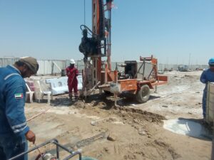
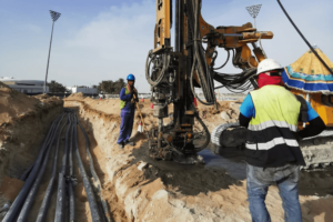
Where a potential conflict depends on an uncertain location or depth, ask the design team to identify the verification needed. Field investigation or trial holes may be appropriate at selected locations, subject to the relevant permissions, utility-owner coordination and safe working arrangements.
Track conflicts and decisions
Record potential clashes between existing assets and proposed pavement, drainage structures, lighting foundations or other works. Each entry should distinguish a confirmed conflict from one that still needs investigation.
Discuss whether the design can avoid the asset, whether protection needs evaluation, or whether relocation needs to be developed with its owner. A relocation shown on a drawing remains a proposal until the relevant technical and coordination issues have been resolved.
3. Coordinate Drainage and Road Levels
Review drainage with the proposed road geometry, rather than treating it as a separate check after the levels are fixed. Changes to the curb line, crossfall and longitudinal profile can alter how runoff reaches inlets and where surface water travels.
The early review should identify:
- Existing road levels, low points and the surrounding areas contributing runoff.
- Available information about inlets, pipes, chambers and downstream connections.
- How the proposed levels connect to entrances, sidewalks and neighboring plots.
- Locations where proposed drainage structures could conflict with utilities.
- Whether existing drainage information is sufficient for the required assessment.
Do not assume that an existing connection can accept the proposed runoff simply because it is nearby. The drainage designer should assess the relevant catchment, network and discharge constraints using appropriate project data.
For example, shifting a curb may leave an existing inlet outside the new runoff path. That issue needs a coordinated drainage and levels solution, rather than a drawing note that merely retains the inlet.
4. Consider Traffic, Safety and Construction Interfaces
Review how the widened road will operate and how construction could affect the existing road. The assessment should reflect the project’s function, users and surrounding development.
Identify the traffic information needed to support decisions about lane use, turning movements and junction connections. Consider property access, pedestrian routes, crossings, visibility, signs, lighting and maintenance access where relevant.
Discuss whether a road safety assessment or audit is required for the assignment, who will undertake it and how findings will be addressed. Confirm the applicable process with the responsible reviewing body rather than assuming that the audit stages used on another project apply.
Construction interfaces also need early attention. Determine whether work can be staged while maintaining access, which utility activities may require outages or temporary diversions, and where temporary traffic arrangements need further development. Allocate responsibility for preparing those arrangements and coordinating their review.
5. Define Design Deliverables and Responsibilities
Agree what the consultant will deliver and how the disciplines will exchange and review information. A road layout alone may not represent the complete package needed for the intended design stage.
Depending on the appointment, the deliverables may include:
- Road geometry, profiles, cross-sections and pavement design information.
- Drainage drawings, calculations and supporting reports.
- Utility coordination plans and proposed protection or relocation details.
- Signs, markings, lighting and associated interface information.
- Coordinated models, clash records and design review responses where specified.
- Submission packages and responses to stakeholder comments within the agreed scope.
State who supplies surveys and utility records, who undertakes additional investigations, and who coordinates specialist designers. Identify responsibilities for checking the combined package and closing interface comments.
If building information modeling (BIM) is included, define the model’s purpose, required information and exchange arrangements. A model can support coordination, but its representation of an existing utility still depends on the reliability of the underlying survey and records.
6. Plan Authority and Utility-Owner Coordination
Identify the road or asset owner, relevant reviewing bodies, utility operators and affected development stakeholders early. Establish which design information each party needs and which decisions depend on their input.
Compile relevant previous correspondence and project-specific conditions. Confirm the applicable submission route, design criteria, document formats and review stages with the responsible parties. Requirements can differ according to the location, ownership, road function and extent of the proposed works.
Clarify who prepares and submits documents, who responds to comments and how revisions will be coordinated across disciplines. Reflect external review dependencies in the design schedule. Review periods and approval decisions should not be treated as guaranteed dates.
Lessons from a Published SAC Infrastructure Project
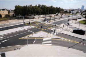
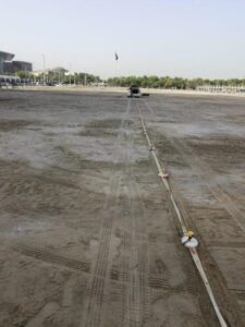
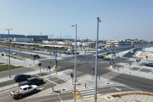
SAC’s published Roads and Infrastructure Design project on Saadiyat Island, listed for 2026, covers approximately 3.9 km of road improvements within Cultural District Package 1E.
The recorded scope includes widening from one to two lanes in each direction, wet and dry utility coordination, stormwater drainage, street lighting, ground improvement and landscaping design. It also includes coordinated BIM models to LOD 300, technical submissions, authority coordination and site supervision.
The relevant lesson is the breadth of interfaces within one road assignment. These are the documented services for that project, not a standard package or model-detail requirement for every widening scheme.
SAC’s separate Infrastructure Design and Roadwork Modification project also records concept, preliminary and detailed road design alongside wet and dry utility integration. It provides another example of design coordination around an existing road layout.
Pre-Design Road Widening Checklist
Before commissioning or advancing detailed design, review the following with your project team. Mark each item as available, to be verified or not applicable, and assign responsibility for unresolved items.
- Location and limits: project location, corridor boundaries and the extent of the proposed works.
- Available drawings: current survey, road plans, as-built records and their dates and revisions.
- Existing road: geometry, levels, pavement information and connections requiring assessment.
- Utilities: available records, asset owners, information reliability and locations needing verification.
- Widening objective: intended lane arrangements, junction changes and operational requirements.
- Drainage: existing assets, runoff paths, proposed level changes and downstream information.
- Access and traffic: property entrances, pedestrian needs, traffic data and construction-stage constraints.
- Coordination: discipline interfaces, stakeholder inputs and applicable review requirements.
- Stage and schedule: current design status, target milestones and dependencies on missing information.
- Consultancy scope: deliverables, investigations, reviews and responsibilities to be included.
The aim is to expose important gaps before design decisions become difficult to revisit. If an item is unresolved, agree how it will be investigated or managed and which decisions depend on it.
How SAC Can Support Your Road Widening Project
Super Arc Consultant provides infrastructure engineering consultancy services covering road design, traffic engineering, utility infrastructure and stormwater management. Its published road projects also demonstrate multidisciplinary design coordination and submission support.
The appropriate appointment may involve a defined road design package, coordination with existing utility networks or support across several connected disciplines. Establish the required services, information inputs and deliverables for the specific project before proceeding.
Discuss Your Road Widening Requirements
Planning road widening in Abu Dhabi? Contact SAC to discuss your road and infrastructure design requirements. Summarize the location, proposed changes, current stage and target schedule, and identify the road, utility and drainage information available. The team can discuss the relevant consultancy scope and agree how supporting documents should be shared.