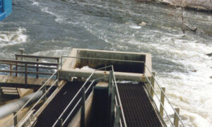
Groundwater is a crucial resource for drinking water, agriculture, and industry. With increasing demand and climate change impacting surface water availability, the importance of efficient groundwater exploration and assessment cannot be overstated. At Super Arc Consultant, specialists in hydrological and hydraulic engineering, we have extensive expertise in addressing groundwater issues. This blog delves into the various methods used to explore and assess groundwater resources.
1. Geological and Hydrogeological Mapping
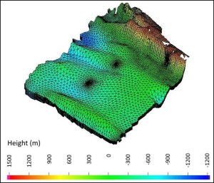
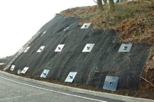
Geological Mapping: This method involves studying the geology of an area to identify potential aquifers. It includes analyzing rock formations, soil types, and geological structures such as faults and folds that influence groundwater occurrence and movement.
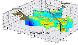
Hydrogeological Mapping: This technique builds on geological mapping by adding data on groundwater levels, flow directions, recharge and discharge areas, and aquifer characteristics. It helps in understanding the hydrogeological framework and guiding further exploration.
2. Geophysical Methods
Electrical Resistivity Surveys: This method measures the resistance of subsurface materials to the flow of electrical current. Different materials, such as dry rocks, wet rocks, and water, have distinct resistivities. By analyzing the resistivity data, geologists can identify groundwater-bearing formations.
Seismic Refraction and Reflection: These methods involve sending seismic waves into the ground and analyzing the returned signals. The travel time and strength of the waves help identify subsurface structures, including aquifers.
Magnetic and Gravity Surveys: These techniques measure variations in the Earth’s magnetic and gravitational fields caused by different subsurface materials. They are used to map large-scale geological structures that may influence groundwater occurrence.
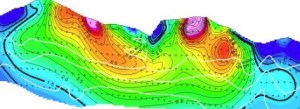
3. Remote Sensing and GIS
Satellite Imagery: Remote sensing involves using satellite images to study the Earth’s surface. Changes in vegetation, soil moisture, and surface water bodies can indicate the presence of groundwater. Thermal imaging can also detect temperature anomalies associated with groundwater discharge.
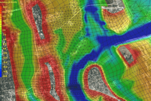
Geographic Information Systems (GIS): GIS is used to integrate and analyze spatial data from various sources, including geological maps, remote sensing images, and field observations. It helps in visualizing groundwater potential zones and planning exploration activities.
4. Hydrological Methods
Water Balance Studies: This method involves calculating the inflows and outflows of water in a particular area to estimate groundwater recharge. It considers factors such as precipitation, evapotranspiration, surface runoff, and infiltration.
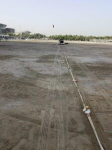
Tracer Techniques: Tracer studies involve introducing harmless chemical or isotopic tracers into the groundwater system and monitoring their movement. This helps in understanding groundwater flow patterns, velocities, and connectivity between aquifers.
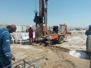
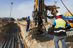
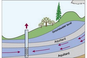
5. Drilling and Borehole Logging
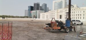
Exploratory Drilling: Drilling boreholes is a direct method to explore groundwater. It provides information about subsurface geology, aquifer characteristics, and groundwater quality. Multiple boreholes are often drilled to map the extent and properties of aquifers.
Borehole Logging: This involves lowering specialized instruments into boreholes to measure various properties, such as electrical conductivity, temperature, and natural gamma radiation. Borehole logs help in identifying aquifer layers and evaluating their potential.
6. Pump Tests and Aquifer Testing
Pumping Tests: These tests involve pumping groundwater from a borehole at a controlled rate and monitoring the water level changes in nearby observation wells. The data collected helps in determining aquifer properties such as transmissivity, storativity, and hydraulic conductivity.
Slug Tests: In this method, a sudden change in water level is induced in a borehole, and the recovery is monitored. It provides information about the hydraulic properties of the aquifer near the borehole.
7. Chemical and Isotopic Analysis
Water Quality Testing: Analyzing the chemical composition of groundwater helps in understanding its origin, age, and interaction with geological materials. Parameters such as pH, salinity, and concentrations of major ions are measured.
Isotopic Analysis: Isotopes of elements like oxygen, hydrogen, and carbon are used as tracers to study groundwater recharge, flow paths, and mixing processes. Isotopic data provides insights into the sources and history of groundwater.
Conclusion
Effective groundwater exploration and assessment require a combination of these methods. By integrating geological, geophysical, hydrological, and chemical data, hydrogeologists can develop a comprehensive understanding of groundwater systems. This knowledge is crucial for sustainable groundwater management, ensuring that this vital resource is available for future generations.