In the world of geotechnical and geophysical engineering, one of the most effective and non-invasive methods of understanding the subsurface is the Multichannel Analysis of Surface Waves (MASW) survey. Whether you’re planning a construction project or need a deeper understanding of soil conditions, MASW Geophysical Survey provide a cost-effective solution to ensure safe and reliable outcomes.
What Is MASW?
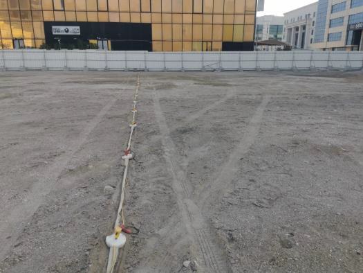
Simply put, MASW is a geophysical survey method that analyzes surface waves generated by a seismic source. These waves travel through different layers of the ground, and their velocities are recorded. By measuring how fast they move through various subsurface layers, we get a clear picture of soil stiffness, structure, and potential hazards.
The MASW method stands out because it’s non-invasive, meaning no drilling or excavation is required. This makes it not only faster but also less disruptive and more cost-effective than other methods.
Why MASW Surveys Are Essential in Geotechnical Engineering
MASW has grown in popularity for several reasons. Let’s take a look at the key benefits it brings to geotechnical and geophysical engineering projects:
1. Non-invasive and Efficient
Since MASW is a surface-based technique, there’s no need for invasive drilling or heavy equipment. This reduces the time and costs involved in gathering subsurface information, making it especially useful in areas where site access may be limited or sensitive.
2. Accurate Soil Profiling
A MASW survey is incredibly effective at profiling the ground and identifying soil and rock layers. The shear wave velocity it measures gives engineers an accurate understanding of soil stiffness, which is critical for assessing foundation designs and understanding potential risks like soil liquefaction.
3. Detecting Subsurface Hazards
MASW helps in spotting subsurface anomalies such as soft soils, voids, and other hazards that could compromise a project’s safety. By identifying these hazards early, engineers can make informed decisions that ultimately save time, money, and potential structural failure down the road.
4. Supporting Foundation Design
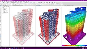
The detailed data from MASW surveys integrates seamlessly with other geotechnical data, enabling better foundation design. By understanding the stiffness and depth of various soil layers, engineers can optimize the design for stability and safety.
How the MASW Process Works
MASW surveys follow a straightforward process:
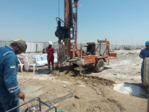
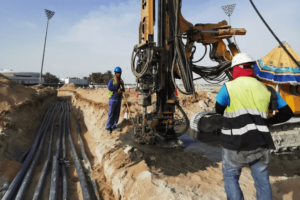
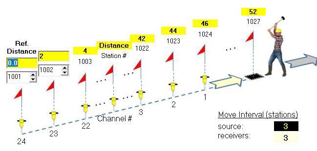
1. Data Collection
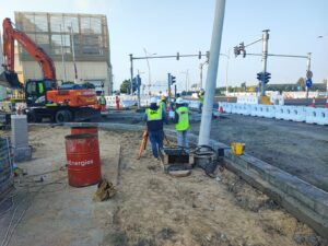
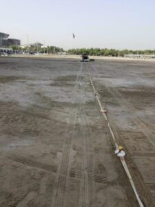
The survey begins by generating seismic waves using sources like hammer strikes or passive sources such as traffic or natural vibrations. A series of geophones placed on the ground record these waves as they travel through the subsurface layers.
2. Data Processing
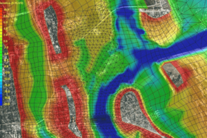
The collected wave data is then processed to evaluate the velocity of surface waves. This process, often involving Fourier analysis, converts time-domain data into frequency-domain profiles to assess the velocity dispersion.
3. Interpreting the Data
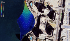
Finally, the data is interpreted to create a detailed subsurface profile. The results give engineers crucial information about the soil’s shear wave velocity, stiffness, and other properties essential for site design and risk mitigation.
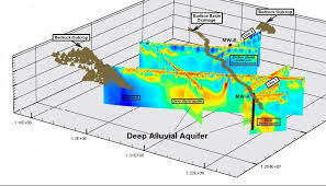
Key Applications of MASW in Engineering
MASW isn’t just useful for a narrow range of projects; its applications are broad:
1. Site Characterization
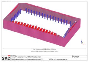
Whether you’re constructing a building, road, or bridge, knowing what’s beneath the surface is critical. MASW surveys provide a detailed understanding of the subsurface, which is essential for choosing the right foundation type and ensuring long-term structural stability.
2. Seismic Hazard Assessment
For projects in earthquake-prone areas, MASW surveys are indispensable. By evaluating the shear wave velocity, engineers can assess how the ground will react during seismic events, which helps in designing structures that can better withstand earthquakes.
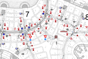
3. Utility and Infrastructure Mapping
In urban areas where infrastructure like pipes, cables, or tunnels may already exist, MASW surveys are an efficient way to map these subsurface utilities, reducing the risk of damaging existing infrastructure during construction.
Why Choose MASW for Your Next Project?
MASW surveys have proven to be one of the most efficient and accurate methods for subsurface investigation. Their non-invasive nature, combined with precise data on soil stiffness and structure, makes them ideal for a wide range of geotechnical projects. Whether you’re concerned about seismic hazards or just want to optimize foundation design, MASW can provide the insights you need.
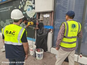
At SAC, we specialize in offering MASW geophysical surveys to support your geotechnical projects. Our expertise in MASW ensures that you receive the most reliable and accurate data, allowing for smarter, safer, and more efficient project planning and execution.
Contact us today to learn how our MASW services can help optimize your next project. Let’s build with confidence, from the ground up!
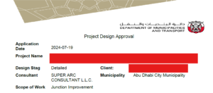
Geotechnical Engineering Services – Super Arc Consultant LLC